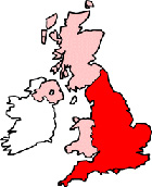
Hereford Herefordshire Map
Map Hereford city centre Herefordshire, England, United Kingdom.
 |
|
Town Centre Map for Hereford Herefordshire UK
Hereford Map: On this page we have provided you with a handy town centre map for the city of Hereford, Herefordshire, you can use it to find your way around Hereford, and you will also find that it is easy to print out and take with you.
If you are visiting Hereford, or perhaps even taking a holiday in Hereford, you will no doubt be looking for local accommodation, facilities and attractions, and this map is perfect for this job. You will be able to find major roads and streets in Hereford, and by using zoom (+) view smaller streets, avenues and lanes in the city, and also bus stops.
Using the map and its many features you can also see: Maylord Shopping Centre, Wye Valley NHS Trust Hospital, Hereford United Football Club Ground (Edgar Street), All Saints C of E Church, Hereford Cathedral Junior School, the Green Dragon, Victoria Street Hereford, Church Ward Trading Estate, Castle House Hotel, Hereford Railway Station (Train Station), Baynton Wood, the Barrels, Widemarsh, Hereford Museum and Art Gallery, The River Wye, Hereford City Sports Club, Holmer Park, The A49, Eign Hill, Hereford College of Arts Media Centre, Broomy Hill, White Cross, Lower Bullingham, Hereford Cathedral and plenty more.
Left click and drag the Hereford map to see areas outside the centre, or click the zoom out button (-) to get a wider view and see Hereford's surrounding areas and nearby places of interest.
More Maps:
Some English City Maps:
- Map of Ely Town Centre
- Map of Manchester Town Centre
- Map of London Town Centre
- Map of Durham Town Centre
- Map of Liverpool Town Centre
Local Town and Village District Maps:
- Map of Kington Town Centre
- Map of Ledbury Town Centre
- Map of Ross-on-Wye Town Centre
- Map of Leominster Town Centre
- Map of Bromyard Town Centre