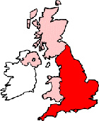
London Greater London Map
Map London city centre Greater London, England, United Kingdom.
 |
|
Town Centre Map for London Greater London UK
London Map: On this page we have provided you with a handy town centre map for the city of London, Greater London, you can use it to find your way around London, and you will also find that it is easy to print out and take with you.
If you are visiting London, or perhaps even taking a holiday in London, you will no doubt be looking for local accommodation, facilities and attractions, and this map is perfect for this job. You will be able to find major roads and streets in London, and by using zoom (+) view smaller streets, avenues and lanes in the city, and also bus stops.
Using the map and its many features you can also see: Queen Elizabeth II Conference Centre, Tottenham Court Road Underground Station, The Royal Opera House, Buckingham Palace Gardens, Oxford Circus Tube Station, Mayfair, St James's Park Lake, Marylebone, Numerous Tube Stations, Palace of Westminster, Newington, Royal Court of Justice, Buckingham Palace, London Coliseum, Temple, St Paul's Church, Charing Cross Railway Station (Train Station), Trafalgar Square, Green Park, St Pancras, Covent Garden Market, Jubilee Gardens, Horse Guards Parade, Churchill Museum and Cabinet War Rooms, Clerkenwell, Pimlico, Theatre Royal Drury Lane and plenty more.
Left click and drag the London map to see areas outside the centre, or click the zoom out button (-) to get a wider view and see London's surrounding areas and nearby places of interest.
More Maps:
Some English City Maps:
- Map of Lancaster Town Centre
- Map of Portsmouth Town Centre
- Map of Stoke-on-Trent Town Centre
- Map of Carlisle Town Centre
- Map of Cambridge Town Centre
Local Town and Village District Maps:
- Map of Sutton Town Centre
- Map of Leyton Town Centre
- Map of New Addington Town Centre
- Map of Beckenham Town Centre
- Map of Bexley Town Centre