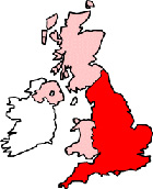
Durham County Durham Map
Map Durham city centre County Durham, England, United Kingdom.
 |
|
Town Centre Map for Durham County Durham UK
Durham Map: On this page we have provided you with a handy town centre map for the city of Durham, County Durham, you can use it to find your way around Durham, and you will also find that it is easy to print out and take with you.
If you are visiting Durham, or perhaps even taking a holiday in Durham, you will no doubt be looking for local accommodation, facilities and attractions, and this map is perfect for this job. You will be able to find major roads and streets in Durham, and by using zoom (+) view smaller streets, avenues and lanes in the city, and also bus stops.
Using the map and its many features you can also see: Trevelyan College, Collingwood College, St Nicholas C of E Church, Shincliffe, Shincliffe Wood, Elvet Hill, Nevilles Cross, St Chad's College, Aykley Heads Recreation Ground, Ustinov College, Little High Wood, Maiden Castle Wood, Borehole Wood, Durham Railway Station (Train Station), the Gates Shopping Centre, Blaid's Wood, Durham University Science Site, Durham Castle, St John's College, Durham Business School, Shaw Wood, Wharton Park, Hopper's Wood, Western Hill.Crossgate Moor, Relley Wood, Durham University Botanical Garden, St Cuthbert's Society, Hollinside Wood, the Gala Theatre, Gilesgate Moor, Pelaw Wood, Market Place, Durham University and plenty more.
Left click and drag the Durham map to see areas outside the centre, or click the zoom out button (-) to get a wider view and see Durham's surrounding areas and nearby places of interest.
More Maps:
Some English City Maps:
- Map of London Town Centre
- Map of Lancaster Town Centre
- Map of Carlisle Town Centre
- Map of Cambridge Town Centre
- Map of Portsmouth Town Centre
Local Town and Village District Maps:
- Map of Willington Town Centre
- Map of Easington Town Centre
- Map of Chester-le-Street Town Centre
- Map of Barnard Castle Town Centre
- Map of Ferryhill Town Centre