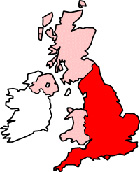
Burslem Staffordshire Map
Map Burslem town centre Staffordshire, England, United Kingdom.
 |
|
Town Centre Map for Burslem Staffordshire UK
Burslem Map: On this page we have provided you with a handy town centre map for the town of Burslem, Staffordshire, you can use it to find your way around Burslem, and you will also find that it is easy to print out and take with you.
If you are visiting Burslem, or perhaps even taking a holiday in Burslem, you will no doubt be looking for local accommodation, facilities and attractions, and this map is perfect for this job. You will be able to find major roads and streets in Burslem, and by using zoom (+) view smaller streets, avenues and lanes in the town, and also bus stops.
Using the map and its many features you can also see: the Post Office Vaults Pub, Market Place Burslem, the Bulls Head Pub, Burslem Fire Station, The A50, The Trent and Mersey Canal, Burslem School of Art, Fowlea Brook, Burslem Park, Tunstall Cemetery, Burslem Library, the Heritage Cafe Bistro, Bradeley Village, Wolstanton, Central Burslem Bus Stop (Town Hall), Grange Park, John Baskeyfield VC Primary School, Middleport, Scotia Brook, Royal Victoria Pottery, Port Vale Football Club, Cobridge Park, Tunstall, the Duke William, Sproson Park, Sneyd Green, Central Forest Park, Haywood Engineering College, Stoke on Trent Gymnastics Centre, Haywood Hospital, Titanic Brewery, Cobridge, Burslem Indoor Market, Moorland Pottery, Middleport Park and plenty more.
Left click and drag the Burslem map to see areas outside the centre, or click the zoom out button (-) to get a wider view and see Burslem's surrounding areas and nearby places of interest.
More Maps:
- Map of Tamworth Town Centre
- Map of Cannock Town Centre
- Map of Norton Canes Town Centre
- Map of Stoke-on-Trent Town Centre
- Map of Newcastle-under-Lyme Town Centre
- Map of Leek Town Centre