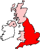
Newcastle-under-Lyme Staffordshire Map
Map Newcastle-under-Lyme town centre Staffordshire, England, United Kingdom.
 |
|
Town Centre Map for Newcastle-under-Lyme Staffordshire UK
Newcastle-under-Lyme Map: On this page we have provided you with a handy town centre map for the town of Newcastle-under-Lyme, Staffordshire, you can use it to find your way around Newcastle-under-Lyme, and you will also find that it is easy to print out and take with you.
If you are visiting Newcastle-under-Lyme, or perhaps even taking a holiday in Newcastle-under-Lyme, you will no doubt be looking for local accommodation, facilities and attractions, and this map is perfect for this job. You will be able to find major roads and streets in Newcastle-under-Lyme, and by using zoom (+) view smaller streets, avenues and lanes in the town, and also bus stops.
Using the map and its many features you can also see: Hands Wood, Newcastle-under-Lyme Tourist Information Centre, Lyme Brook, Newcastle-under-Lyme College, Knutton, the Cherry Tree Pub, Oscars Restaurant, Royal Infirmary, May Bank, Wolstanton, Newcastle Sixth Form College, the Old Brown Jug Pub, University Hospital of North Staffordshire, The New Victoria Theatre, Blackfriars School, The A52, Clayhanger Guest House, the Golden Lion in Newcastle, The A34, Gypsy Caravan Site, Newcastle-under-Lyme Police Station, The A53, Keele University Medical School, Newcastle-under-Lyme Baptist Church, the Full Moon Pub, Castle Walk Shopping Centre, Vue Cinema, Harplands Hospital, Westlands, Newcastle-under-Lyme High Street, Basford, Friar's Wood and plenty more.
Left click and drag the Newcastle-under-Lyme map to see areas outside the centre, or click the zoom out button (-) to get a wider view and see Newcastle-under-Lyme's surrounding areas and nearby places of interest.
More Maps:
- Map of Leek Town Centre
- Map of Cheadle Town Centre
- Map of Gnosall Town Centre
- Map of Stoke-on-Trent Town Centre
- Map of Perton Town Centre
- Map of Tunstall Town Centre