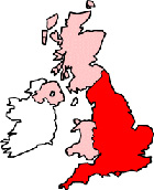
Shaldon Devon Map
Map Shaldon town centre Devon, England, United Kingdom.
 |
|
Town Centre Map for Shaldon Devon UK
Shaldon Map: On this page we have provided you with a handy town centre map for the town of Shaldon, Devon, you can use it to find your way around Shaldon, and you will also find that it is easy to print out and take with you.
If you are visiting Shaldon, or perhaps even taking a holiday in Shaldon, you will no doubt be looking for local accommodation, facilities and attractions, and this map is perfect for this job. You will be able to find major roads and streets in Shaldon, and by using zoom (+) view smaller streets, avenues and lanes in the town, and also bus stops.
Using the map and its many features you can also see: Shaldon Beach, Shaldon Botanical Gardens, the Ness Shaldon, Devon Valley Holiday Village, Shaldon Approach Golf Course, Shaldon Bridge, Shaldon Wildlife Trust (Shaldon Zoo), Ness Cove Beach, Coast View Holiday Park, Ness Cove, Teignmouth, Ringmore, the Shipwrights Arms (pub), the Clipper Cafe, the River Teign, Marine Parade, Teignmouth to Shaldon Ferry, Shaldon Methodist Church, Shaldon Primary School, Shaldon Parish Church (St Peter the Apostle), Bridge Road, Fore Street and plenty more.
Left click and drag the Shaldon map to see areas outside the centre, or click the zoom out button (-) to get a wider view and see Shaldon's surrounding areas and nearby places of interest.
You will find this map very helpful if you are visiting Shaldon in Devon this year. Perhaps you are having a holiday in Shaldon or maybe you are looking for a map of Shaldon Zoo (shown as Shaldon Wildlife Trust on the map). Shaldon Zoo has many rare and endangered species from all around the world. You might be looking for The Ness, Shaldon, a stunning Georgian hotel and restaurant located on the Teign Estuary. To see The Ness on the map you will need to click the zoom button (+) once. Maybe you are planning to stay in one of the Shaldon beach huts, for which the resort is famous, or at the nearby Coast View Holiday Park (click zoom once on map), with its heated indoor swimming pool. It could be that you are just heading to Shaldon for the evening and popping in to one of the local Shaldon pubs such as the London Inn Shaldon (not shown on the map but located on The Green), the Shipwrights Arms Shaldon (click zoom once to view), or the Ferry Boat Inn Shaldon (not shown on map but in Strand). Whatever it is you are looking for in Shaldon, don't forget to visit Shaldon Beach where you can enjoy the sunny Shaldon weather and top up your tan (we will be adding a Shaldon weather forecast to this page shortly).
You can also use this Shaldon map to find restaurants in Shaldon, supermarkets near Shaldon or find your way to the Shaldon ferry point (Shaldon to Teignmouth Ferry) which offers a passenger ferry service daily for foot passengers, and people with dogs, bicycles and pushchairs.
You can book Shaldon hotels using the booking module below and find Shaldon holiday cottages, apartments or rentals by clicking on the "cheap local accommodation" box.
Shaldon History: The true history of Shaldon is a little unclear as the current village is built upon reclaimed land, largely created by the building of a retaining wall during the 19th Century. This wall prevents the land being sucked back into the River Teign. There has been a settlement in the area (probably nearer to Ringmore) since the time of the Norman conquest (and possibly earlier) and it was certainly settled by the Saxons. Crossing the River Teign to Teignmouth was somewhat treacherous until the building of a wooden bridge in 1827.
More Maps:
- Map of Teignmouth Town Centre
- Map of Plymouth Town Centre
- Map of Exeter Town Centre
- Map of Torquay Town Centre
- Map of Babbacombe Town Centre