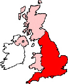
Oxford Oxfordshire Map
Map Oxford city centre Oxfordshire, England, United Kingdom.
 |
|
Town Centre Map for Oxford Oxfordshire UK
Oxford Map: On this page we have provided you with a handy town centre map for the city of Oxford, Oxfordshire, you can use it to find your way around Oxford, and you will also find that it is easy to print out and take with you.
If you are visiting Oxford, or perhaps even taking a holiday in Oxford, you will no doubt be looking for local accommodation, facilities and attractions, and this map is perfect for this job. You will be able to find major roads and streets in Oxford, and by using zoom (+) view smaller streets, avenues and lanes in the city, and also bus stops.
Using the map and its many features you can also see: St Edmund Hall, Corpus Christi College, Wolfson College, South Park, Worcester College, Oxford Railway Station (Train Station), Ifley, The River Thames (Isis), the Bear Inn, the Mitre Pub, Lady Margaret Hall, Queen's College Recreation Ground, Park Town, Merton College, St Ebbe's Church, University College, St Aldgate's Parish Centre, Sommerville College, Trinity College, Christ Church Cathedral School, Christ Church Cathedral, Exeter College, Linacre College, Oxford High Street, the Sheldonian Theatre, Westgate Shopping Centre, Oxford Town Hall, Gloucester Green, Brasenose College Recreation Ground, St Peter's College Recreation Ground, Headington Hill, the Turf Tavern, St Hilda's College, Museum of History & Science, The River Cherwell, Nuffield College, Christ Church Meadow, Oxford University Press, Pembroke College, Grandpont, Bodleian Library, Keble College, Mansfield College, New Hinksey, Oxford Station, the Clarendon Centre (Shopping Centre) and plenty more.
Left click and drag the Oxford map to see areas outside the centre, or click the zoom out button (-) to get a wider view and see Oxford's surrounding areas and nearby places of interest.
More Maps:
Some English City Maps:
- Map of Ripon Town Centre
- Map of Worcester Town Centre
- Map of Leeds Town Centre
- Map of Newcastle Town Centre
- Map of St Albans Town Centre
Local Town and Village District Maps:
- Map of Bicester Town Centre
- Map of Wantage Town Centre
- Map of Abingdon Town Centre
- Map of Charlbury Town Centre
- Map of Didcot Town Centre